Archives
Great Basin Water Network
The Pipeline
Southern Nevada Water Authority
Groundwater Development Project
Site Map
Maps
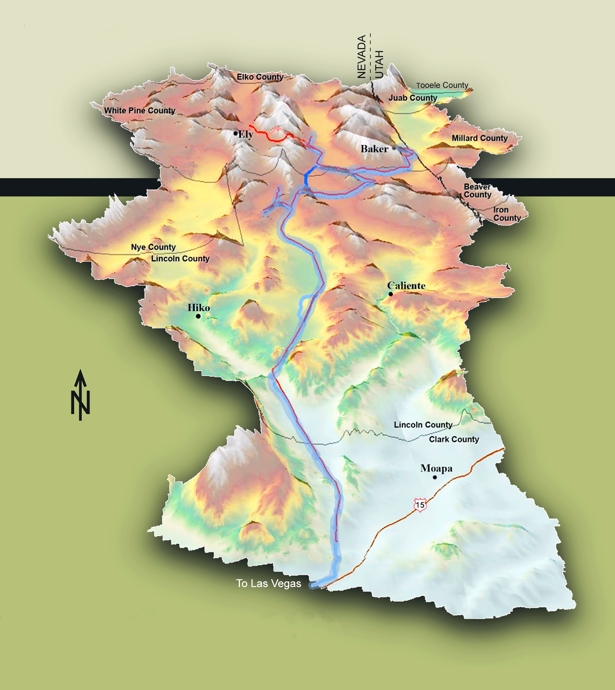
The map shown below depicts the full alignment, including proposed facilities of the proposed Groundwater Development Project. The online Goggle Map depicts the northern portions of the project area. The statewide color map shows the ratio of committed water resources to perennial yield by basin. The 3D graphic map was taken from the BLM's Environmental Impact Statement for the Clark, Lincoln, and White Pine Counties Groundwater Development Project.
Proposed Facilities1
- Buried Storage Reservoirs &
Water Treatment Facilities
- Construction Support Areas
- Pressure Reducing Stations
- Electrical Substations
- Pump Stations
- Proposed Power Line
- Proposed Pipeline Alignment
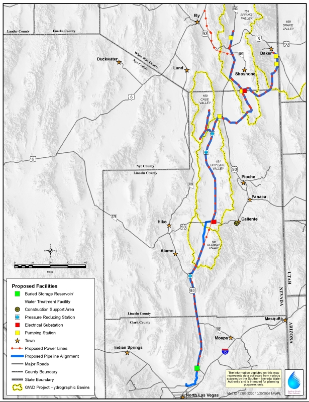
Maps were obtained from the Southern Nevada Water Authority
View Larger Map
State of Nevada — Ratio of Committed Water Resources to Perennial Yield by Basin — Source: Overview of Water Resource Issues Legislative Commissions Subcommittee to Study Water — Nevada Division of Water Resources Monday, February 8, 2016

Archives Home Page
Great Basin Water Network Home Page
|